Description
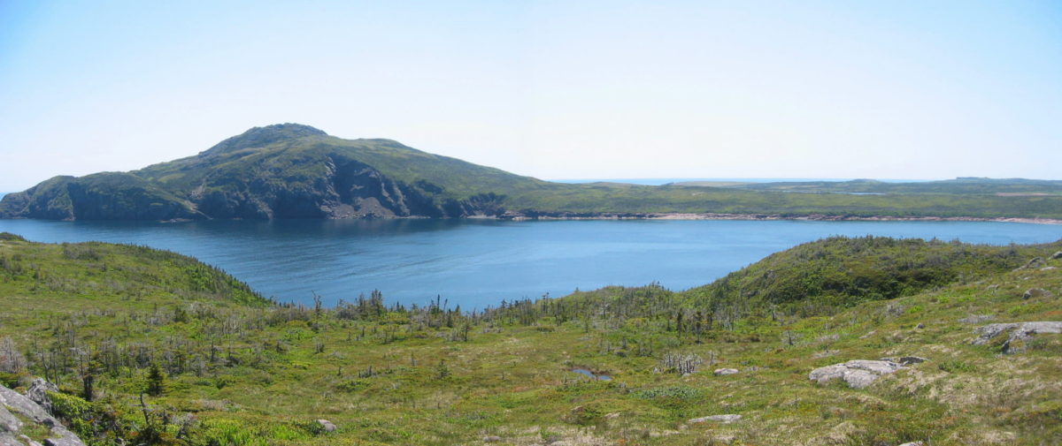
Cape Chapeau Rouge is a coastal landmark fronting Placentia Bay at the entrance to St. Lawrence, NL. This is the highest point of land on the south coast located 2.5km west of Sauker Head and 4km east of Ferryland Head. The designation encompasses the entire area.
Statement of Significance
Formal Recognition Type
Municipal Heritage Building, Structure or Land
Heritage Value
Cape Chapeau Rouge has been designated a municipal heritage site by the Town of St. Lawrence due to its aesthetic and historic values.
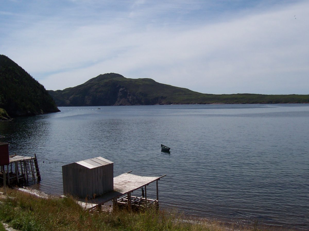
Cape Chapeau Rouge has aesthetic value due to its environmental setting. Used as a navigational mark for centuries, at 226m above sea level this land feature is located on the highest point of land on the south coast. Cape Chapeau Rouge was a signal to early fishers that a safe harbour was near and its expansive beaches were useful for fishermen who exploited the cod fishery. There is a rarity of good harbours along this shore and the coast is fogbound with treacherous currents. Cape Chapeau Rouge is found on rutters (sets of sailing directions) dating to 1579. Cape Chapeau Rouge got its name for its appearance, though ancient records say that the mountain changes shape as one moves towards it traveling by sea. Its appearance is most striking when fog is hovering about it and it has been said it resembles the crown of a hat, a lion, a bust, a broken turret, a rough dome and a broken, irregular, craggy, inaccessible mountain.
Cape Chapeau Rouge has historic value because it has a connection with the French fishery. France was an important participant in the exploration and exploitation of Newfoundland. By the time French explorer Jacques Cartier arrived in Newfoundland waters in 1534 Breton, Norman and Basque fishermen had been fishing there for decades. French Basque fishermen appear to have been the first fishermen in Placentia Bay. There is an abundance of French place names to support this theory of early settlement by the French. French Basque had a ready supply of salt and concentrated on the cod fishery and St. Lawrence’s safe harbour is listed among the busiest in the bay. The French Basque set up summer rooms (fishing premises) at the base of Cape Chapeau Rouge, but no permanent settlement took place. During the seventeenth century the French fishery reached its peak and its only competitor was the English fishery, who they outnumbered by two to one in fishing vessels. The French concentrated their efforts in two main areas of Newfoundland, one of which took in Placentia Bay, encompassing St. Lawrence, among others. This area was known as la cote du Chapeau Rouge and the fishers came mostly from ports in Brittany. In addition to the migratory fishery the French set up year-round settlements in these areas. Cape Chapeau Rouge was used by the French to guide them to the fishing grounds and safe harbours, which was particularly important, considering the fog and unpredictable currents.
Source: Town of St. Lawrence Motion 05-127, August 16, 2005.
Character Defining Elements
All those elements that define the cape, including:
-the untouched, natural landscape;
-the lack of structures and buildings, and;
-the view of the cape from the ocean as a mariner’s guide.
Location and History
Community
St. Lawrence
Municipality
Town of St. Lawrence
Civic Address
Cape Chapeau Rouge
Construction (circa)
1520 - 2005
Location
Similar Heritage Properties