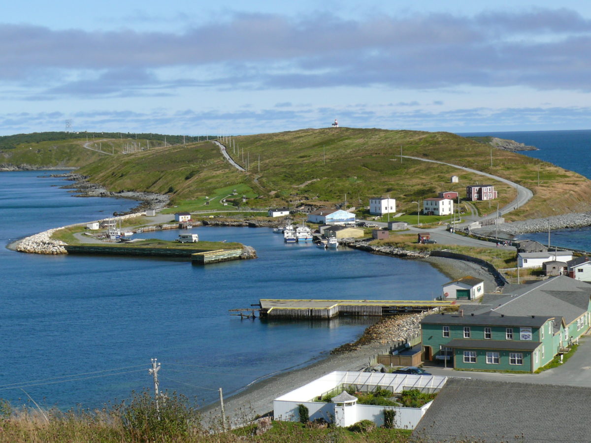
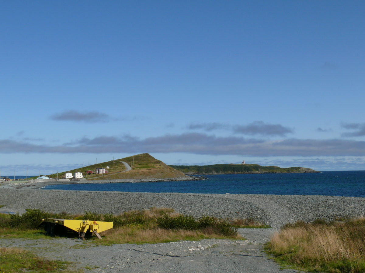
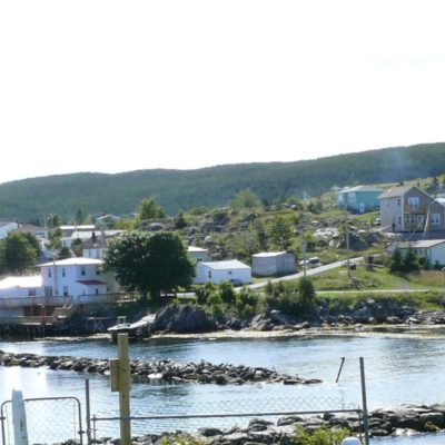
The Downs Historic Conservation Area is located within the municipal boundaries of the Town of Ferryland, NL. It encompasses a peninsula referred to locally as The Downs, a rising ground mainly devoid of trees and surrounded by the waters of the North Atlantic on the north, east and south, and connected to the mainland on the west by a narrow isthmus. Ferryland Head, the eastern extreme of the peninsula, is also included in the designation. The principal physical elements of the district are open fields, traditional gardens, an unpaved road, treed areas, wetlands, diverse marine landscapes and a light station. The Downs Historic Conservation Area begins just east of the northern end of Beach Road and continues along the peninsula to the rock formation Hare’s Ears to the extreme east. Excluded are the sheltered harbour known as The Pool as well as all lands under archaeological survey to the north of Lighthouse Road.
Formal Recognition Type
Municipal Heritage District
Heritage Value
The Downs Historic Conservation Area was designated a municipal heritage district by the Town of Ferryland due to its natural/ecological, aesthetic, historical, cultural and scientific values.
The Downs Historic Conservation Area has natural/ecological value due to the variety of natural features contained within its boundaries. Its marine landscapes range from cobble and sandy beaches to sheer rock cliffs. The Downs to the west is a rising ground devoid of trees with open fields and gardens. “Downs” can be defined as an area of open, rolling, sloping land covered in grass. To the east the peninsula turns south and low shrubs, mosses, lichens, small flowering plants and wetlands dominate. Rocky outcrops along Ferryland Head are reminiscent of the earliest known European name for Ferryland, the Portuguese term “farelhao” meaning steep rock, reef or point.
The district has aesthetic value as a landmark in the community, the region and the province. The peninsula was a signal to early fishers that a safe harbour was near, and its expansive beaches were useful fish drying spaces for those who exploited the cod fishery. Along a shore typified by deep harbours, Ferryland is open to the Atlantic Ocean, with The Downs and Ferryland Head jutting out prominently from the coastline.
The historical value of the district is tied to sponsored settlement in the 1600s and later settlement by English and Irish immigrants. In 1621 Sir George Calvert (later Lord Baltimore), sponsored a settlement in Ferryland. The availability of pastureland on The Downs was an attraction for this settlement and the area continues to be used by Ferryland residents for small vegetable gardens and hay. This idyllic setting was also the site of a serious conflict the winter of 1787-88 that saw over one hundred Irishmen fined, flogged or transported after a fraction fight between men from the Irish provinces of Leinster and Munster. Ferryland Head, the eastern extreme of the district, has historic value due to its ties with marine transportation along the Southern Shore of the Avalon Peninsula. Located along a major shipping route, the light station has provided navigational aid to ships crossing the Atlantic and journeying between Newfoundland and the North American mainland.
The cultural value of the district is most obvious in the community’s use of the space. Ferryland Head and The Downs have long been the site of traditional pursuits for residents, such as berry picking, bird hunting and subsistence farming. Of further cultural value are the oral history and legends surrounding the district. Local men were often called to Ferryland Head to rescue sailors and passengers from ships that ran aground on the treacherous shores, and related stories are part of the community’s oral tradition.
The district has further cultural value due to its association with Newfoundland artist Gerald Squires, who lived at the light station for several years. While there he served as Artist in Residence for Memorial University’s extension program, hosting artists and teaching art classes. His “Ferryland Downs” series found much of its inspiration in the rugged landscape of The Downs and environs.
Potentially important archaeology sites contained within its boundaries give the district scientific value. Archaeological surveys have shown that the area was fortified from Calvert’s time until the 1800s. A rusting canon on the road to the light station is evidence of the district’s military role. Large scale development in the adjacent Pool area might have spilled over onto the lower Downs when George Calvert’s settlement reached its capacity. Legend has it that Lady Sarah Kirke, the entrepreneurial widow of Sir David Kirke who succeeded George Calvert, is buried on The Downs, although archaeological surveys to date have not uncovered a graveyard.
Source: Town of Ferryland Municipal Plan, November 1998.
Character Defining Elements
All those elements that embody the natural/ecological, historical, cultural, aesthetic and scientific values of The Downs Historic Conservation Area, including:
– the untouched, natural landscape, especially the integrity of the variety of natural features including marine landscapes, topographical features and variety of flora;
– the lack of structures and buildings;
– the view of the Downs from the ocean as a mariner’s guide;
– all original features which relate to the age, style and use of the light station:
– its coastal siting;
– unobstructed view plane from Southern Shore Highway;
– unobstructed view planes to and from the district;
– continued public use of traditional pathways, open spaces and garden spaces, and;
– large number of archaeological features and resources, particularly the canon on the road to the light station and other large military related artifacts on the landscape.

 Google map
 Website